Mountain Biking in Cairns and Atherton
 Most destinations offer up trails of a particular flavour, but Tropical Far North Queensland has so much variety to offer that it’s very hard to pigeonhole—there really is something for everyone.
Cairns needs little introduction as a tourist destination. With the Great Barrier Reef just off-shore and virgin rainforest tumbling down the steep-sided mountains, it’s promoted as the only place on earth where two world heritage areas meet.
From a mountain biker’s perspective, the region has a longstanding and somewhat ominous reputation. Since the late 80s Cairns bred riders have amazed us with their seemingly fearless riding, producing names such as Michael Ronning, Sean McCarroll, Ben Bramham, John Dall-ozzo and Rodney Meares—I’ll always remember Meares for his insanely loose riding style on the steepest trails. Their skills were honed on the root riddled and precipitous trails that plunge down from the rainforest covered peaks. Back in the early 90s, Cairns had a well-developed MTB scene and the technical nature of their trails often baffled those from the southern states.

While there is a very strong gravity scene in and around Cairns with no shortage of challenging downhill tracks, we found that the region offers great diversity with mountain biking opportunities for just about everyone—from families and first timers through to advanced level riders looking to push their limits. Our week-long road trip started in Cairns where we picked up a camper from Apollo Motorhomes; this gave us great flexibility and convenience, allowing us to explore and camp along the way.
Cassowary Coast
After rising early to catch the flight to Cairns, we kicked off with some of the more cruisy riding in the region at Mission Beach, a two hour drive to the south. If you’ve never been to Cairns before, the drive south provides a great perspective on just how mountainous the area is. Lowland cane fields occupy a narrow band along the coast and the mountains loom vertically above. Mt Bartle Frere is the most impressive peak; at 1,622 metres it’s the highest point in Queensland and only a few kilometres in from the coast. You can hike to the top from Josephine Falls if you’re feeling energetic and after some off-the-bike activity—the trail is pretty rugged and the peak receives around eight metres of rainfall annually, so be prepared!

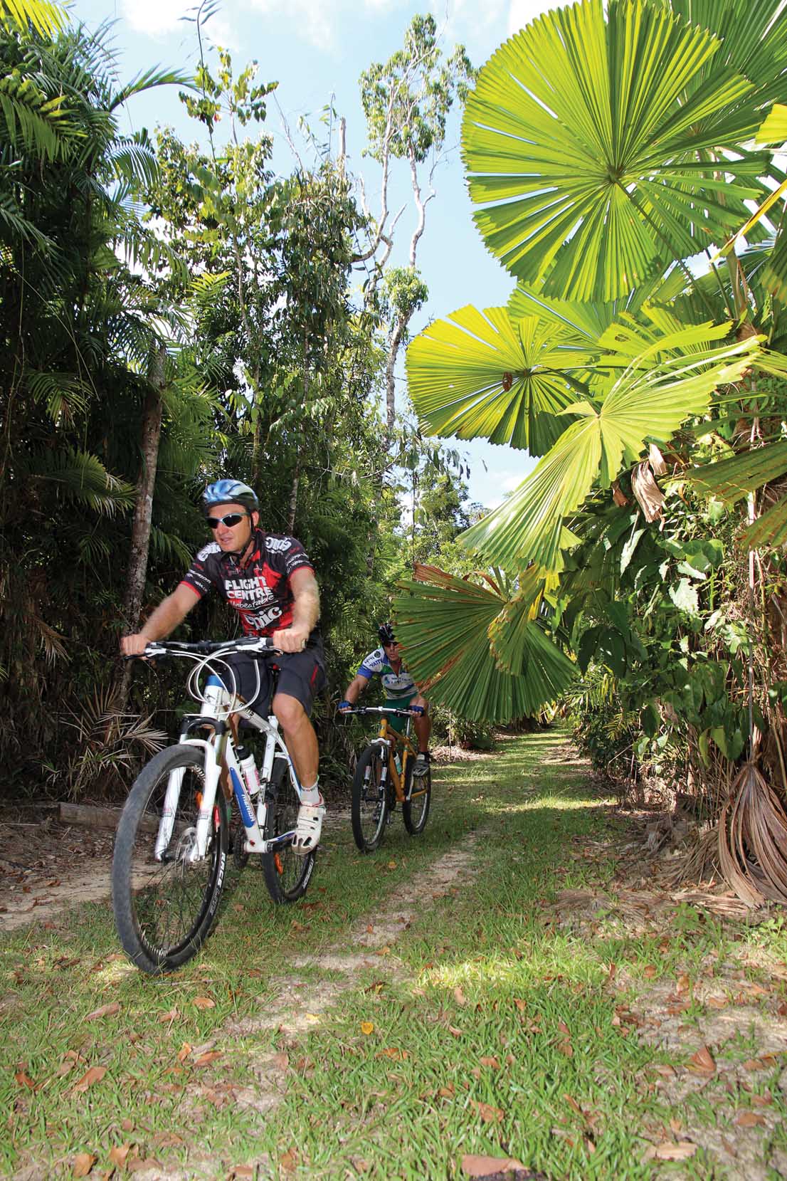
We avoided these shenanigans and headed to the Musgravea Trail in the Djiru National Park. This is an old logging trail that’s recently been opened to mountain bikers. It’s a relatively flat and non-technical ride that’s suitable for beginners and kids—a good one for the whole family. The trail takes you through world heritage listed rainforest and it’s not uncommon to spot a cassowary whilst you pedal quietly along—we caught a glimpse of one as it disappeared behind the ferns.
The trail is 6km each way and can be ridden as an out and back or linked with the road at the opposite end (it connects the Licuala day use area with El Arish-Mission Beach Road). In preparation for the wet season, much of the track had been capped with lumpy railway ballast. This took much of the fun away from the ride but apparently it beds in after a while and the track once again becomes smooth and fast. In some places it’s quite overgrown, forcing you to duck the Licuala Fan Palms that line the trail.
From here it was a quick road jaunt back to Mission Beach for something a little bit different. Beach riding is usually a bit of a slog but not here; with Dunk Island just off the coast, the beach is well protected and the relatively coarse sand packs down to become very firm. You can easily scoot along at 25kph—no fatbike required. This beach ride is popular with local mountain bikers, who do it as a night ride when there’s a full moon and finish with a beer at the Surf Life Saving Club on the Esplanade at South Mission Beach—what a way to complete a tropical evening! Mission Beach is 10km long and it makes for a great family ride—it’s also a perfect introduction to mountain biking if you have a non-riding partner. Check with the Cassowary Coast Bicycle User Group Facebook page if you want to hook up with Mission Beach locals for a ride (www.facebook.com/ccbikeriders).

Other rides in the area include the Tully Gorge (ride 9km along a rough gravel road to Coachable Creek Camp for a walk and swim) and there’s a maze of forestry tracks around the Cardwell Forest Drive; highlights include Attie Falls and the ‘Spa Pool’. You’ll also find riding in Wooroonooran National Park (the Misty Mountain Trails). Most of these areas offer dirt track riding, often with spectacular swimming holes, but you’ll need to look elsewhere if you’re chasing a singletrack fix. We did just that and headed inland towards Atherton.
Atherton
Sitting up on the tablelands at 750m, Atherton is a bit over an hour’s drive south west of Cairns. This elevation makes the area a few degrees cooler than to coast and appreciably drops the humidity, making for a reasonably pleasant year-round riding climate (it’s not unlike Brisbane in its average temperature).
Of course the real drawcard for Atherton is the quality singletrack, and there’s lots of it! The trails are located in state forest to the west of town and have been used informally by mountain bikers since the early 90s. In 2010/11 a local group proposed the trails should be formalised as a way of attracting tourism. The Tablelands Integrated Mountain Bike Alliance (TiMBa) developed a long-term strategy and the community has been very supportive of it. World Trail drew up a concept plan and they were contracted to do the work. To begin with Queensland Parks and Wildlife (QPWS) kept a tight rein on the project, reluctant to let the construction stray far beyond the existing informal trail corridors (even where moving the trail entirely would make it more sustainable). Over time trust and respect developed and now QPWS rangers often engage with World Trail for guidance on sustainable trail building techniques.
Now only small portions of the original trails exist and the trail network has grown from 10-20km to around 35km of singletrack. This is set to more than double in the coming years with around 65-100km of singletrack being the end-goal.
Finding the trails is easy; you just head out of town on the Atherton-Herberton and turn off at Rifle Range Road—just follow the signs for the Atherton Forest Mountain Bike Park. I stayed at the Woodlands Big 4 caravan park which is a short ride to the trailhead—it’s always nice to hit the trails without having to load up the car.
Distinct from the costal rides, Atherton’s trails weave their way through dry and open sclerophyll forest with the occasional patch of grass trees and even a waterfall or two depending on the season. It’s more rocky than root riddled and some of the rocks are quite jagged, so look out tyre sidewalls!
World Trail has really stamped their style on the Atherton trail network—you can pick it almost straight away when you hit the newly built trails. They are flowy and swoopy with bermed corners making a regular appearance. Even the climbs are kind of fun and less of a slog than you’d expect; World Trail employs what they call a ‘climb, climb, rest ratio’ that puts little descents at intervals to break up an extended climb.

Currently the trail network features a fairly unimaginative numerical naming system, as preferred by some of the local parks management. However you’ll still find creative signage from the original trail builders and there are informal trail names that are used by the locals. Highlights include Ridgy Didge (trail 6); it starts with an enjoyable climb from the bottom of the hill before following a ridge line with good views and lots of rocky technical trail features. Trail 7 or Bandi Bandi offers one of the tougher uphills followed by a ripper descent that makes it all worthwhile. As the name suggests, Waterfalls (Trail 11) can be spectacular after rain and it also contains plenty of interesting features including a 180-degree rock-armoured berm.
Ricochet (Trail 9) is the go-to trail if you’re chasing big berms and jumps; it’s the main attraction for the DH crowd but there’s no reason why you can’t ride it on an XC bike (it actually featured in the 2013 Croc Trophy). You can ride or shuttle to the top (a 3km long, 250-metre vertical climb up a baking hot dirt road), or pedal up via the more pleasant singletrack network. It’s a trail that you’d probably want to ride a few times to learn your lines before attacking any of the bigger jumps.

To my mind the ‘funnest’ trail in Atherton is the newly built Trail 8 (The Hack). It’s an optional extra off the side of Ridgy Didge and it rates as one of the swoopiest grin-inducing tracks I’ve ridden in a while. It’s fun and achievable at any speed but the optional lines open up once you turn up the speed—a real World Trail classic!
Future plans for Atherton extend well beyond the bike park. The long-term goal is to utilise the disused rail lines from Mareeba to Atherton and Atherton-Herberton to create a long-distance off-road route through the region. This rail trail will serve to link points of interest or ‘hubs’ such as the Atherton MTB park. You’ll be able to leave the car behind and do a long-distance off-road tour that takes in great bits of singletrack off to the sides.

As it stands you could happily spend a few days in Atherton, and even more as the planned trail extensions are built. While the local attractions mightn’t be as ‘known’ as Cairns, it is tourist town in its own right and there are plenty of non-bike related activities if you’re going with the family or just want to look around. Much of the focus is on the locally produced tropical fruit wines and organically grown coffee (you can even download an app from www.athertontablelands.com.au that points you towards the local culinary attractions).
While the region produces some great food, don’t expect to find too much choice when dining in town. Many of the good restaurants are located in the surrounding hills, so a drive may be in order if you want to explore beyond the handful of eateries in town. Beyond the food you’ll find waterfalls littered throughout the region as well as Lake Barrine and Eacham; two volcanic craters that have filled with water to form 65 metre deep lakes—great spots to swim and walk. You can also climb Mt Baldy for a better view of the region and a look at Mt Bartle Frere from an entirely different perspective.
Davies Creek

Next up we headed back towards Cairns and stopped in to check out the stomping ground of the Mareeba Mountain Goats. The trail head is located on Davies Creek Road, which turns off the Kennedy Highway around 15km east of Mareeba (or 40km west of Smithfield, Cairns). There’s a dirt parking area on the left approximately 3km along Davies Creek Road and the trails are on the right hand side of the road.
When I visited, there was a sign to direct you towards the trails and white plastic roadside posts had been used to mark the trail loops. The carpark and signage was all funded by the Mountain Goats club, but QPWS is in the process of formalising the network with IMBA standard trail marking. In its present state, you’d be best off riding with a local to make the most of the trails and avoid getting lost. There’s usually someone who’s keen to show a visitor around and you can get in touch via the Mareeba Mountain Goats Facebook page. If you can’t tee up a local rider, a GPS file can be downloaded from www.mareebamountaingoats.com—between this and the white marker posts you’ll be pretty right.

The club formed around three years ago with the goal of providing local cyclists with an alternative to riding on the often dangerous roads in the region. In this time the membership has grown from 10 to 100 and they’ve received great community support along the way.
This grassroots nature is reflected in the style of trails that you’ll encounter within their ‘Little Transfield’ network (QPWS is likely to rename it Davies Creek). It’s 75% singletrack but the trails are fast, open and non-technical—the sort of riding that would make a great introduction to singletrack riding for a newcomer. There are five loops totalling 21km of riding, and this includes a singletrack loop for kids. Most trails are rated as ‘green’ (easy) under IMBA guidelines and the ‘blue’ intermediate trail isn’t much harder; it’s just got some steeper uphills and a bit more distance involved. Only the ‘Balboa’ trail gets a little rocky but there’s nothing scary at all.
Riding at Davies Creek provides a real contrast to nearby Cairns; it’s only a half-hour drive in from the coast but the bush is dry and open with gentle gradients and big ant hills. Fast draining granite soils allow year-round riding and it’s not quite as humid as the coastal areas, making it a more pleasant option if you’re looking to ride during the wetter months.
In addition to formalising the singletrack, there are also plans to promote the off-road touring route from Cairns to Mareeba. This 50-60km route already exists but it’s an unmarked ‘choose your own adventure’ that takes you past Copperlode Dam, through Davies Creek and onto Mareeba. From there you’d be able to link it with the yet to be finished Mareeba to Atherton rail trail.
Smithfield
Located just behind the James Cook University campus (approximately 15km north of the Cairns CBD), the Smithfield trail network is easy to find and well set up. There’s a great pump track at the trail head, excellent trail signage and it seems that whenever you roll up, there’s always a crowd of mountain bikers milling around. Hang out at the trail head and you quickly get a sense that Cairns is the heart of a strong and bustling MTB scene.

More than 50% of the trail network was closed at the time, as World Trail was hard at work developing the course for the 2014 UCI World Cup round that’s coming up in late April (see Page XX). Once complete, the trails will be open to the public, giving you an opportunity to ride the course before the big event.
Smithfield has around 12km of singletrack in total, ranging from easy green trails through the valley floor (Green Fields, Flat Snake etc) through to steep double black diamond DH runs that’ll really keep you honest (National DH, Cuss Cuss and Happys). Many sections of the World Cup XC will be of black diamond and double black diamond standard, adding more challenge to the Smithfield trail network.
Once you slip out of the fields and under the rainforest canopy, the trails are often steep with plenty of matted tree roots that turn super slick once wet. There are jumps, small drops and with the frequent traffic, there’s the occasional rut that can catch you out. All in all, the riding is interesting and engaging for intermediate to experienced riders. Black Snake is one of the most enjoyable trails; it switchbacks steeply up a narrow ridge before launching you down a berm and jump filled rollercoaster that will have you cutting laps until your legs give out.
If you’re looking for more within the same area, check out the nearby Kuranda DH (it ducks into the bush 100 metres down from the lookout on Kennedy Highway) or hook up with locals to ride the Bom track which drops down from the top of the range and finishes in the Smithfield MTB Park.

Port Douglas
The Bump Track is only 6km long (plus a few kilometres along the flatlands to get back into town) but it’s an iconic descent. It’s the highlight of the RRR, Australia’s longest running point-to-point MTB marathon event, but you don’t have to ride the full 70km route from Mt Molloy to descend the Bump. We hooked up with Bike N Hike Adventure Tours and got a lift to the top of the hill for a night time run down the hill. It’s a 45 minute drive to the top and they’ll supply the bike and lights (a Giant Reign or Trance) if you don’t have your own. This makes it an appealing option if you’re holidaying sans bike in Port Douglas and want to sneak out for a ride without impinging on family time.
Initially I thought doing the Bump at night would take away from the scenic experience but it actually made it more interesting. With high powered LED lights strapped to our helmets, we got to see more of the local wildlife than you normally would and Bike N Hike provides a bit of historic background along the way—the Bump was the main access route to the goldfields in the late 1800s and it used to take the bullock trains four days to ascent the six kilometre long hill!
Starting at an elevation of 400 metres, the first few kilometres are gently undulating on smooth trails. It may be fire road width but a single line has formed from all the MTB traffic, giving it the feel of singletrack. A steep pinch takes you through a creek crossing and back up again before the descent proper starts. The bulk of the 330-metre vertical loss takes place over 2km of trail, which gives an indication of the gradient—it’s pretty steep! The trail is also littered with waterbars; none are real ‘kickers’ but you still need to ride within your limits—hitting the deck at high speed is bound to be nasty.
From the bottom it’s a leisurely pedal back into Port Douglas via the beach to grab a coffee at one of the many cafés. Bike N Hike Adventures usually runs their Bump Track night runs on Wednesday and Sunday nights during summer and almost every night during peak season (winter). Group sizes can range from two up to eight and it costs $88 per person—that includes the bike and LED lights.
Between the casual rides along Mission Beach and the flat-out fun of Atherton; the cruisy singletrack of Davies Creek and the challenging Smithfield trails, the greater Cairns region has a lot of variety to offer. The riding alone is sufficient to justify a MTB road trip—especially if you can time it to coincide with the World Cup. Thankfully a trip to Cairns or Port Douglas is also pretty easy to justify with non-riding family members, as Far North Queensland is a world class tourist destination in its own right.
It’s well worth scheduling a few non-riding days to check out the local attractions. Whether it’s scuba diving or snorkelling on the reef, relaxing on the beach or tripping through the Daintree, there’s heaps to do and see—I can’t wait to go back!
World Cup XC Course
Cairns is no stranger to elite level racing. Over the years they’ve hosed national series rounds for both downhill and cross-country as well as World Cup events—the pinnacle being the 1996 UCI World MTB Championships. After a 21-year hiatus the World Championships are set to return in 2017, and the World Cup round on 26-27 April 2014 is the prelude (plus there will be another World Cup in 2016).
World Trail has been hard at work preparing the course, and by the time you read this, much of it should be open to the public. Having ridden in the 90s era World Cup events, I was curious to see what had changed and if the trails lived up to my memories from 18 years ago. Back then the Smithfield course was groundbreaking and deemed super technical—the first World Cup event to use the Myndas descent scared the bejesus out of many top level competitors!
Surprisingly, the updated World Cup will share many sections with the original course. It’s just been tweaked and brought up to speed with current construction techniques, ensuring that the trail is built to last. World Trail has also added features and optional lines that will add to the spectacle and give technically advanced riders more opportunities to gain time. The course will also have open sections with technical features to provide good viewing for TV and spectators.
The downhill also follows a similar alignment to the 90s World Cup course, just with heavily reworked obstacles to challenge the world’s best. With around 250 metres elevation loss, the downhill is expected to take the top riders around three minutes.
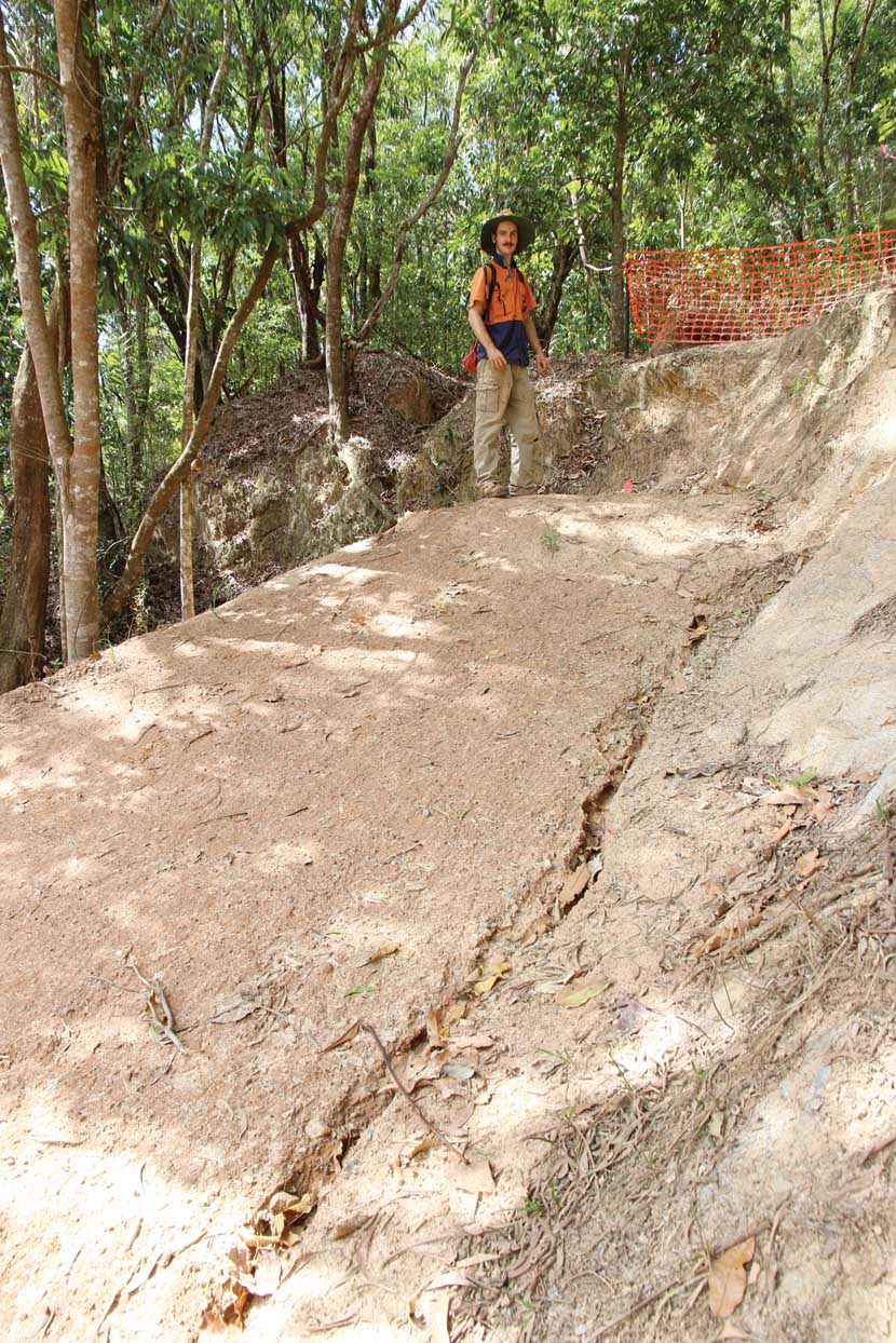
Entering back into the event centre, riders will have the option of launching this big step-down gap. It’s got a substantial transition but I don’t know that I’d be doing it on a lightweight hardtail with the saddle at full XC height! The B-line is on the right of the photo and is also very steep.
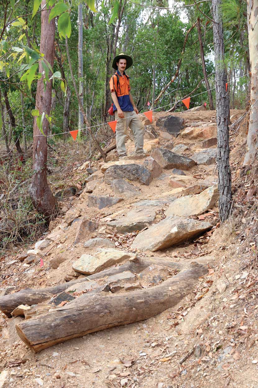
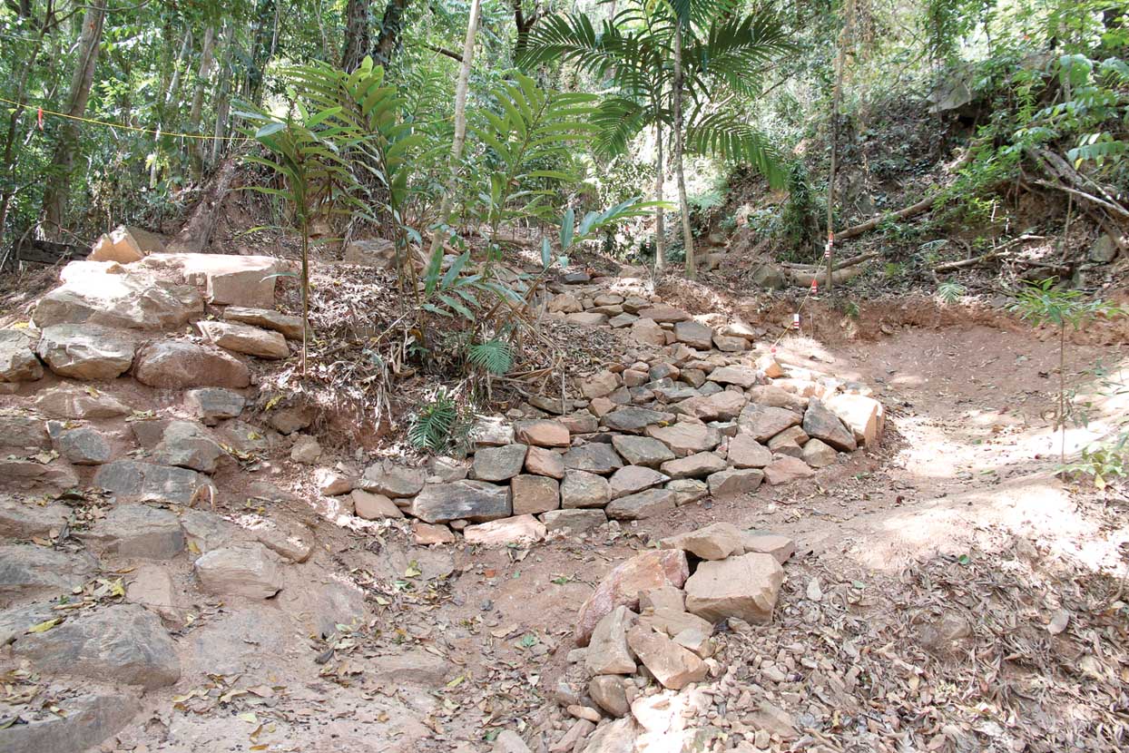
This is a revamped part of the old Myndas descent—steep with plenty of big rocks and the diagonally placed log will be tricky if it’s wet, which is a distinct possibility in April.
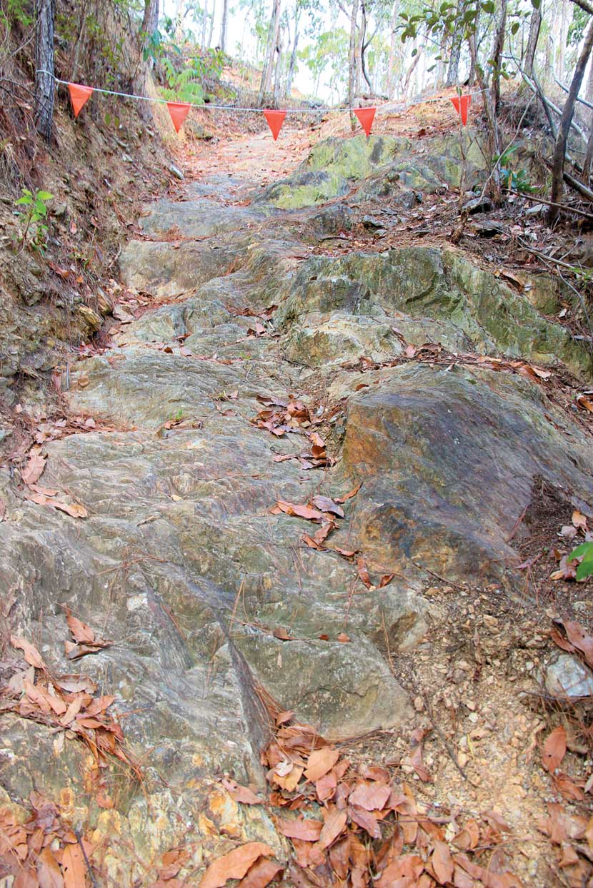
Back in the 90s ‘The Schute’ was covered in loose shale, now it’s just a sheer rock face—very steep and it’ll be very slippery when wet. Perhaps it’ll become ‘Schurters Chute?’
This is the reworked Jacobs Ladder. The old star pickets and railway sleepers have been removed. Note the optional A-line on the left of the photo; rather than taking the switchback, there’s an opportunity to take the metre or so drop—will some of the elite XC riders be game to try this line?
General Information
Getting Around
Direct flights are available from all Australian capital cities, although many flights go via Brisbane. Unless you are staying put at a resort or in town, you’ll probably want a rental of some sort to get around. We opted for a camper van, which was well suited to our road trip chasing the best riding destinations. The Apollo ‘Euro Tourer’ had two beds, a toilet, a full kitchen with a fridge and a shower, which was extremely welcome after a hot and steamy ride. Plug it in at a caravan park and you even had 240v power for the TV and microwave.
Accommodation
You’ll find a Big 4 Holiday Park close to every MTB destination that we’ve mentioned. All have a range of accommodation options; from simple camp sites through to multi-berth self-contained cabins with fully appointed kitchens. In addition to the accommodation, all of these parks have pools and playgrounds to keep the kids entertained. For bookings and other details go to www.big4.com.au

Beachcomber Coconut Caravan Village, Mission Beach: Offers absolute beach frontage with views out to Dunk Island. Ride from your accommodation straight out onto the hard-packed sand and away! There’s also a BYO restaurant on site if you don’t feel like cooking.
Atherton Woodlands Tourist Park: Located just two kilometres from the trailhead, this park lets you leave the car behind once you arrive in Atherton.
Crystal Cascades Holiday Park: Tucked up against the ranges, this park is just 5km from Crystal Cascades—a series of beautiful waterholes that are perfect for a post ride dip. It’s a 14km drive to the Smithfield MTB Park from here.

Glengarry Holiday Park, Port Douglas: Located on Mowbray River Road, the Glengarry is right at the bottom of the Bump Track and a 10 minute drive into the heart of Port Douglas. It features an awesome pool slide and a big jumping pillow in the playground—a sure-fire hit with the kids.

When to Visit
As a tropical climate, Cairns is warm all-year round with distinct wet and dry seasons. It’s probably best to avoid the wet season (December through to March), as the heat and extreme humidity makes riding unpleasant. Atherton isn’t as humid, making it a great year-round destination, although it can still cop very high rainfall at times during the wet season. Winter maximums are usually around 26 degrees while the summer average is 32 degrees. Atherton is usually six degrees cooler with lower humidity.
Bike Shops
You’ll find a number of well stocked bike shops throughout Cairns. Both Discovery Cycles and BikeStop Espresso are within a five minute drive of the Smithfield trail head.
Northern Bikes is the only store in Atherton but it’s a lot more upmarket than your average country town bike shop—you won’t find them dabbling in lawnmower repairs! They have a full workshop and stock plenty of good quality gear.
Innisfail Cycle and Sports is the closest store to Mission Beach—it’s a half hour drive.
There are two bike shops in Port Douglas; PD Bike Works (www.pdbikeworks.com) and Port Douglas Bike Hire (www.portdouglasbikehire.com).
Handy Links
Atherton Trail information - www.cairnstrails.com
Mareeba Mountain Goats club - www.mareebamountaingoats.com
Cairns MTB Club – www.cairnsmtb.com
Cassowary Coast Multisport Club Inc (Mission Beach MTB) 0434 019 515
Cassowary Coast BUG – www.facebook.com/ccbikeriders
Bike N Hike Adventure Tours (Bump Track, Port Douglas) - www.bikenhiketours.com.au
Cairns Mountain Bike Tours (hire and guided tours) - www.cairnsmountainbiketours.com
General Attractions - www.cairns-greatbarrierreef.org.au


